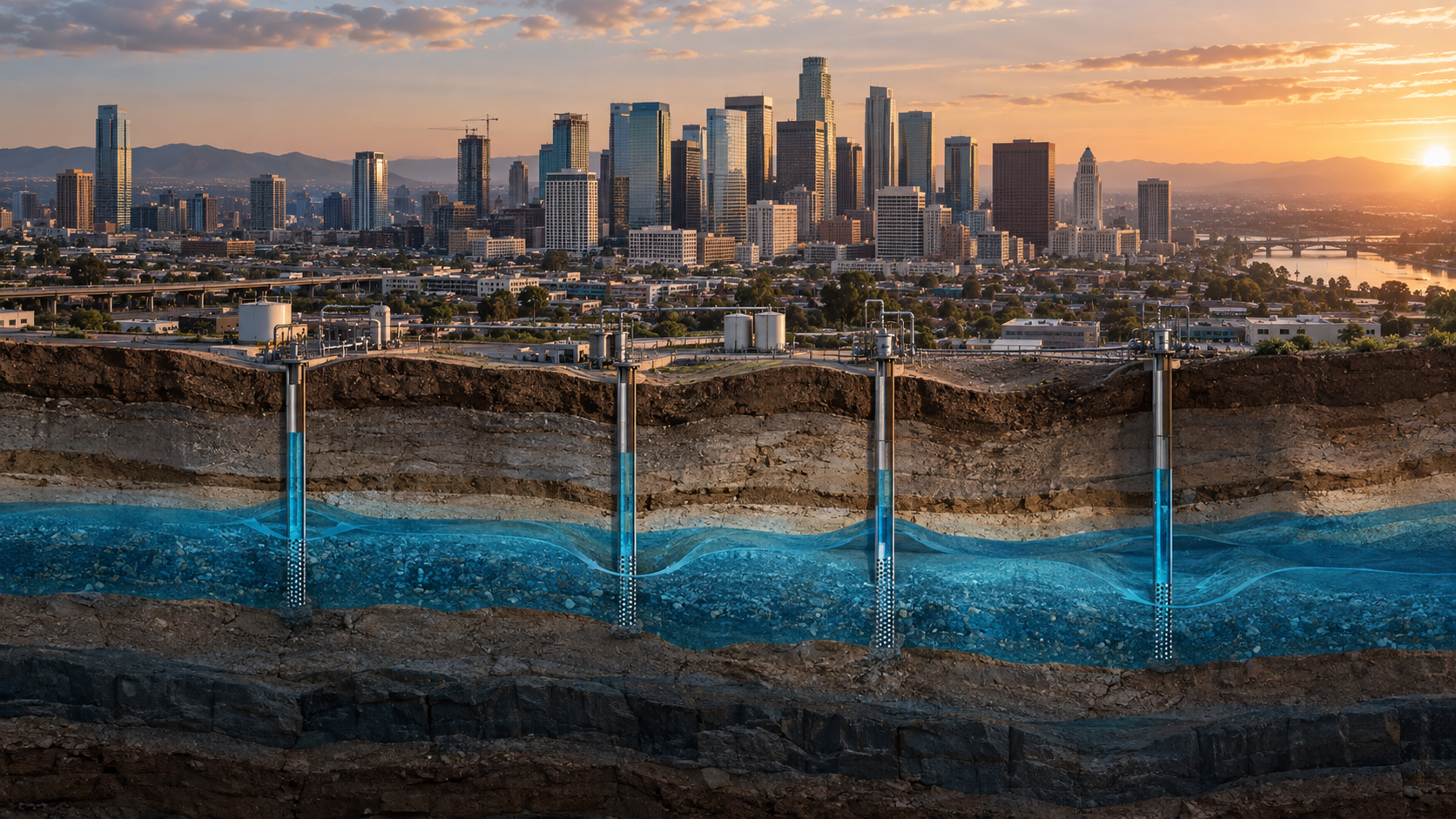
The ground below a city is not always solid rock
Many cities and farming regions sit on thick layers of sand, silt and clay laid down by rivers, lakes or ancient seas. Those sediments contain tiny spaces, called pores, that can hold groundwater.
When the pores are filled with water, some of the pressure underground is carried by that water. Pump enough groundwater out and the pressure drops. In aquifers that contain compressible clay and silt, the grains can be squeezed closer together under the weight above them.
The result is land subsidence: the ground surface gradually settles downward.
A NASA–ISRO satellite recently watched this happen from orbit
In 2026, NASA reported that the NASA–ISRO Synthetic Aperture Radar mission — NISAR — mapped subsidence around Mexico City. Radar measurements taken between October 25, 2025 and January 17, 2026 showed some areas sinking by up to a few centimetres per month.
Mexico City is especially vulnerable because much of it was built over the sediments of an ancient lakebed. Those soft deposits can compact as groundwater is extracted. The city has relied heavily on groundwater for decades, while the weight of urban development adds more stress to the ground.
The important lesson is not that every city will sink at the same rate. It is that modern radar can now measure tiny vertical movements over huge urban areas — sometimes before the damage is obvious to people standing on the street.
Why a few centimetres can become a major problem
A city does not need to drop by metres overnight to suffer damage. The worst problems often come from uneven sinking.
If one part of a neighbourhood subsides faster than another, roads can warp, building foundations can crack and buried water or sewer lines can be pulled out of alignment. Drainage systems can also lose the slope they were designed around, increasing flood risk in low areas.
Subsidence can also reduce the capacity of canals, levees and aqueducts. In agricultural regions, that can affect the infrastructure used to move water precisely when water is already scarce.
This has happened on a huge scale before
The U.S. Geological Survey says groundwater use is responsible for more than 80% of the known land subsidence identified in the United States. In California's San Joaquin Valley, one famous location subsided by roughly nine metres between 1925 and 1977 because of groundwater withdrawal and aquifer-system compaction.
That does not mean every aquifer behaves the same way. Subsidence depends heavily on local geology. Coarse sands and gravels behave differently from thick, compressible clay layers. But the basic risk is well established: sustained pumping can remove support, compact sediments and lower the land surface.
It is also a water-storage problem
Subsidence is often treated as an engineering problem because cracked roads are easy to see. But there is a second problem underground.
If clay-rich layers are compressed enough, the pore spaces that once stored water can shrink permanently. That means an aquifer can lose some of its future storage capacity.
Think of an aquifer less like an underground lake and more like a giant water-filled sponge made of rock and sediment. If part of that sponge is crushed, simply adding water later does not necessarily restore its original shape.
Overpumping can cause other problems before the ground even sinks
Groundwater depletion can lower the water table until shallow wells stop working. Pumps then have to lift water from greater depths, using more energy and increasing cost.
Pumping can also change the relationship between aquifers and rivers. Streams that once received groundwater can lose that inflow, affecting wetlands, vegetation and wildlife. In coastal areas, excessive pumping can pull salty water inland and contaminate freshwater supplies.
Subsidence is therefore one visible symptom of a larger imbalance: taking groundwater out faster than nature and managed recharge can replace it.
Can a sinking city be fixed?
The most important step is to reduce the imbalance between pumping and recharge. That can mean limiting extraction, improving irrigation efficiency, repairing leaks, capturing stormwater, recharging aquifers deliberately and using surface water when it is available.
Monitoring matters too. Satellite radar, GPS stations and groundwater wells can show where land is moving and where water levels are falling. The earlier a dangerous trend is detected, the more options planners have before expensive infrastructure is damaged.
Some aquifers can rebound slightly when water levels recover. But severe compaction of fine-grained sediments can be largely irreversible. Prevention is much cheaper than rebuilding a city around permanently lowered ground.
What this means for ordinary people
If your tap still works, groundwater can feel invisible. But in many places it is part of the hidden infrastructure beneath daily life: drinking water, irrigation, factories, rivers and ecosystems all depend on it.
That is why groundwater management is not only about whether a well runs dry. The deeper question is whether we are changing the physical structure of the ground while extracting the water.
The slow disaster is easy to ignore
Earthquakes announce themselves in seconds. Subsidence can happen quietly for years.
That makes it easy to postpone action. A road may crack and get resurfaced. A pipe may break and get replaced. A building may need reinforcement. Each failure looks local, while the underlying cause can stretch across an entire aquifer.
Satellites such as NISAR are changing that. They can reveal the pattern from above: not one cracked street, but whole districts moving vertically at different speeds.
The ground beneath a city can feel permanent. In reality, what we pump from below it can slowly change where “ground level” actually is.